

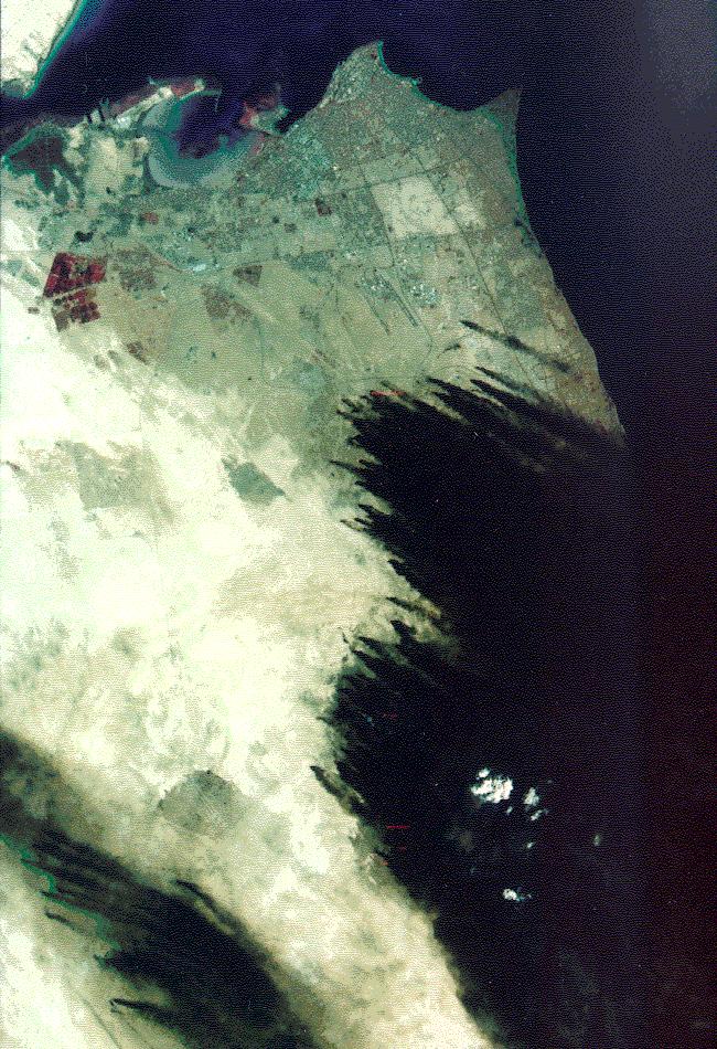
Imagery acquired by US Landsat remote sensing satellites document the orchestrated destruction of Kuwaiti oil fields by the occupying Iraqi forces. By 03 March, at the conclusion of the ground campaign, some 600 wells were lit and the area was shrouded in smoke.
SOURCE: Reproduced with permission of Earth Observation Satellite Co. (EOSAT) Lanham, Maryland USA