


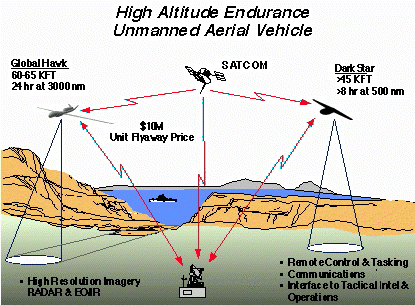
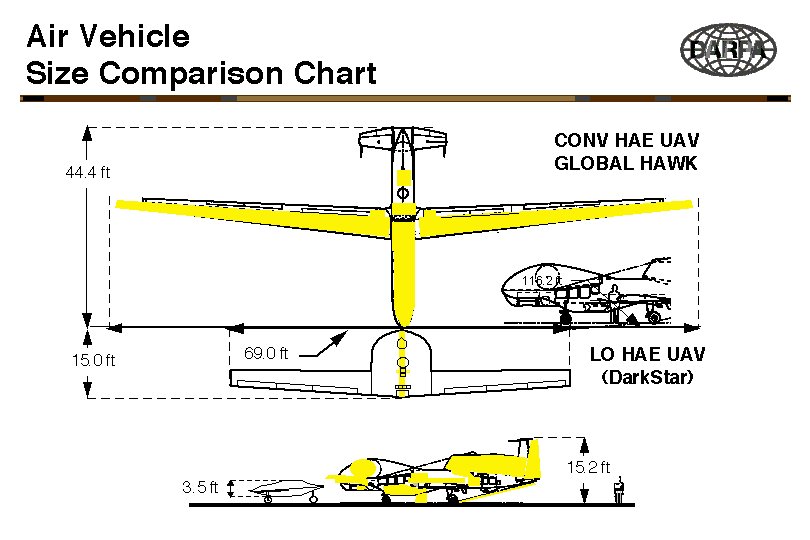
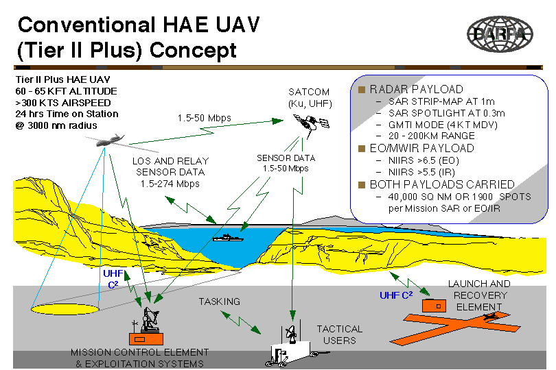
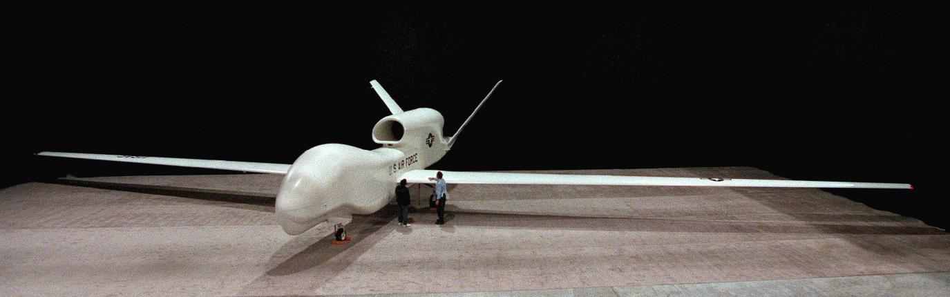
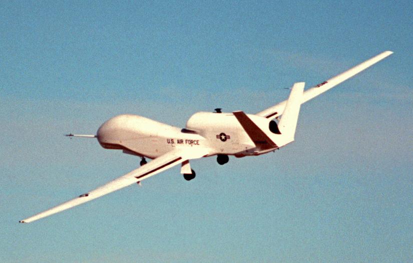
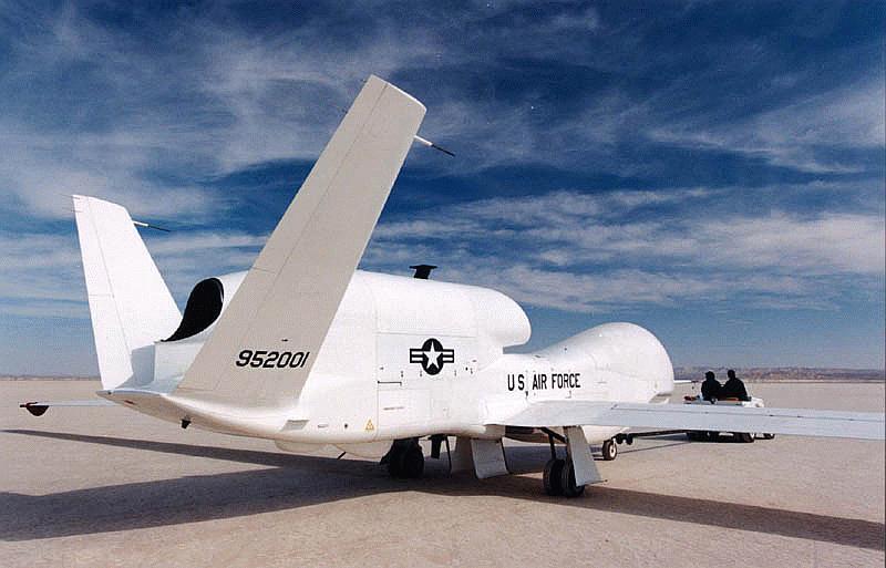
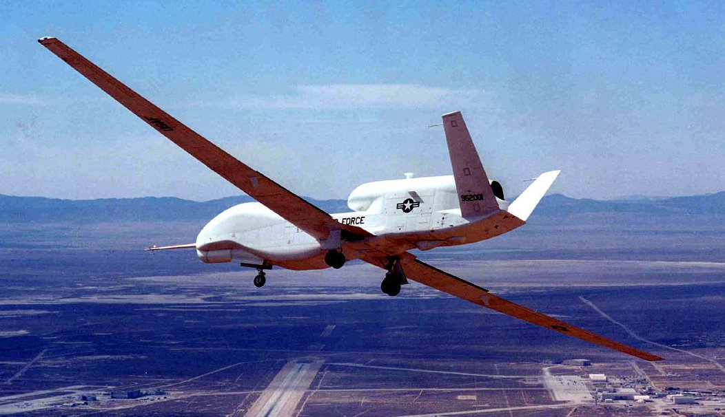
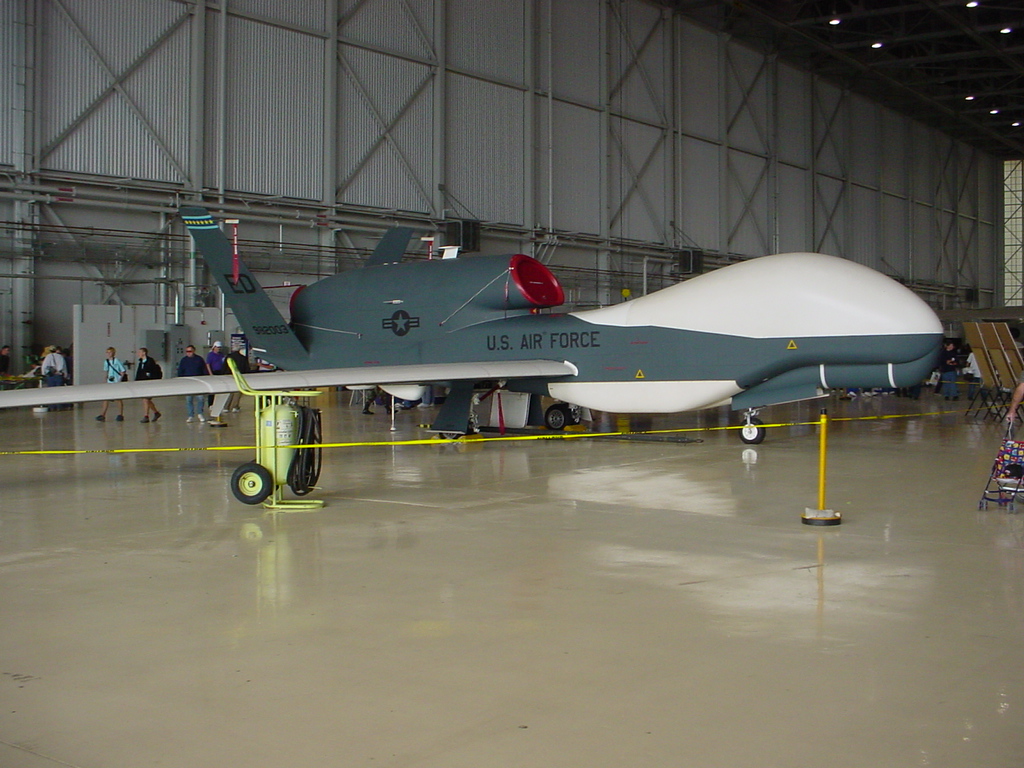
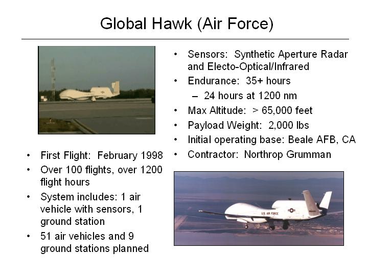
The Tier II Plus air vehicle will be capable of standoff, sustained high altitude surveillance and reconnaissance. It will operate at ranges up to 3000 nautical miles from its launch area, with loiter capability over the target area of up to 24 hours at altitudes greater than 60,000 feet. It will be capable of simultaneously carrying electro-optical (EO), infra-red (IR), and synthetic aperture radar (SAR) payloads, and will be capable of both wideband satellite and Line-Of-Sight (LOS) data link communications. During the development phase, scheduled to conclude 1QFY98, two vehicles, two sets of payloads, and a ground control station will be procured and field tested. Global Hawk's first flight was from Edwards Air Force Base, CA on 28 February 1998.
The HAE UAV will be capable of long dwell, broad area coverage, and continuous spot coverage of areas of interest with high resolution sensors. Global Hawk's 24-hour operationally persistent dwell will support persistently viewing and tracking targets like critical mobile targets. The Global Hawk is focused on the radar integrated into the system for all-weather, wide-area and spot capability that can provide high quality imagery with targeting accuracy.The Global Hawk radar and EO/IR payload are carried simultaneously. Radar is capable of multiple modes -- SAR strip at one meter, SAR spot at a foot, GMTI mode down to four knots operating all at 20 to 200 kilometers range. The EO/IR payload provides NIIRS 6 or 5.5 depending on whether it's EO or IR. Global Hawk will integrate with the existing tactical airborne reconnaissance architectures for mission planning, data processing, exploitation, and dissemination. It will provide both wide area search radar and EO/IR imagery (40,000 sq nm per mission) at 1m resolution and up to 1900 spot images per mission at 0.3m resolution, and will support targeting accuracy of at least 20m CEP.
When linked with systems such as the Joint Deployable Intelligence Support System (JDISS) and the Global Command and Control System (GCCS), imagery may be transferred NRT to the operational commander for immediate use. HAE UAV data will be accessible for Indications and Warning (I&W), cueing, rapid strike/restrike tasking, combat assessment and further analys is up and down the chain of command within minutes of receipt.
The HAE UAV will strive for commonality with existing Command, Control, Communications, Computers, and Intelligence (C4I) architecture. Collected imagery will be transferred to theater designated exploitation sites utilizing standard formats through existing communications mediums. Selected frames of imagery and reports can be broadcast electronically by voice or data. The operational commander will determine the preferred means of dissemination and distribution.
The system is capable of both direct line of sight communications with the ground station by a common data link or beyond line of sight through Ku band SATCOM, direct line of sight capability, good support up to 274 megabits per second (although this is not currently supported) and 50 megabits per second by a Ku band SATCOM. In the future users detached from the ground station could directly receive imagery data from the Global Hawk.
When Global Hawk missions are allocated to Army commanders, or an Army officer is the JTF commander, the Enhanced Tactical Radar Correlator (ETRAC) and Modernized Imagery Exploitation System (MIES) (or successor processors) will process the imagery. If the U.S. Air Force is the "lead" Service, the processor would be the Contingency Airborne Reconnaissance System (CARS); if the Navy and Marines go in first, the Joint Services Imagery Processing System-Navy (JSIPS-N) would process the imagery. The Common Ground Station (CGS) will display the imagery no matter which system processed it.
In fiscal year 1999, Global Hawk flying quality flights were flown, and military utility flights were to commence in April. In March, 1999, a Global Hawk vehicle, with its sensors, went out of control and was destroyed. This crash has delayed the Global Hawk military utility study at least two months,
On 16 February 2000 Northrop Grumman Corp. of San Diego CA was awarded a $71,999,635 modification to a cost-plus-award-fee contract, MDA972-95-3-0013, to provide for two prototype Global Hawk unmanned aerial vehicles, associated system modification, and engineering support. Expected contract completion date is March 31, 2002.
