APPENDIX A
FUTURE TRENDS IN COMMERCIAL
SPACE-BASED REMOTE SENSING
This appendix provides information expanding on that discussed in Chapter III, Ocean Monitoring. Topics covered include: Electro-Optical imagery, Synthetic Aperture Radar imagery, synergy of different imagery systems, SMALLSAT development and hyperspectral imagery.
ELECTRO-OPTICAL TRENDS
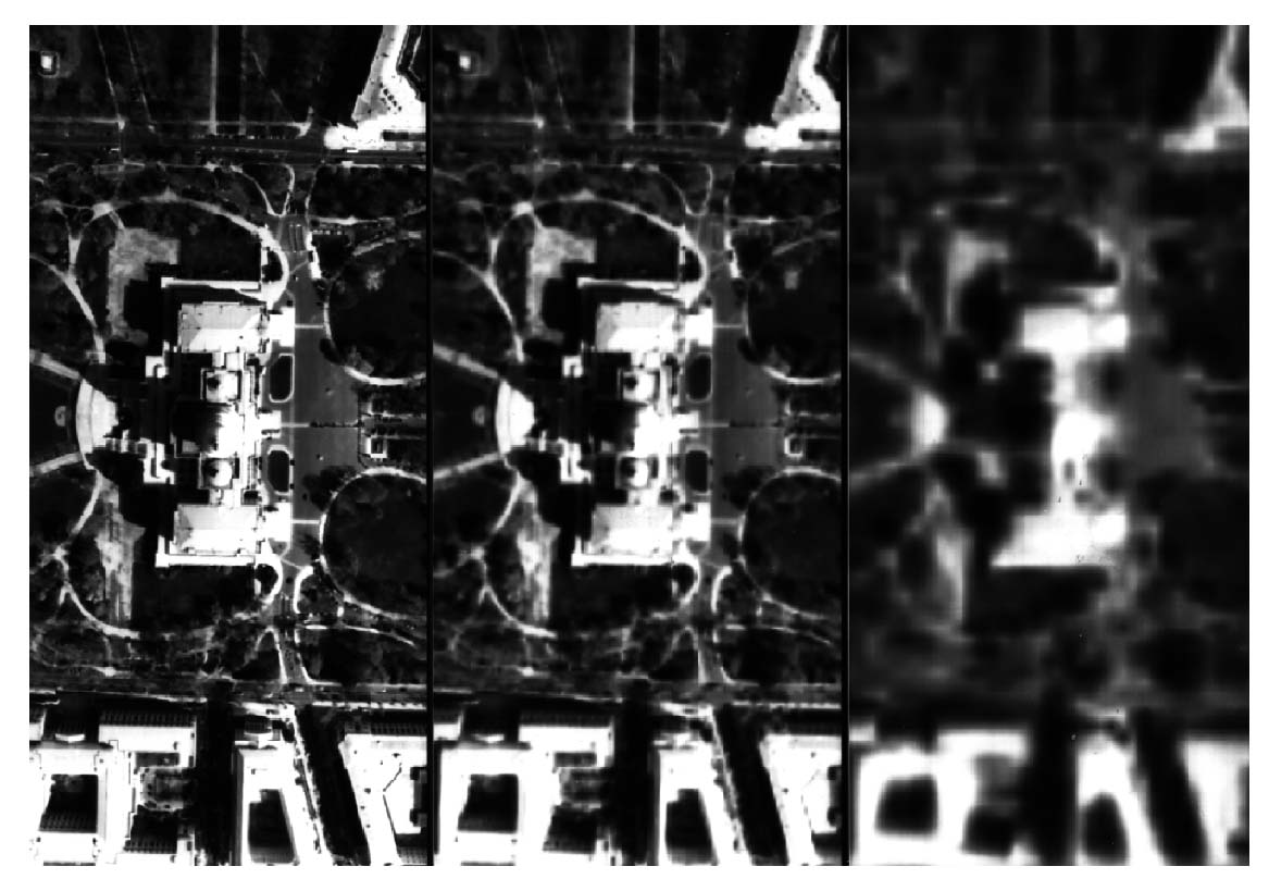
Commercial electro-optical imagery is moving rapidly from 10 M resolution (1994 standard) to 1-m resolution (1999 standard) as shown in this image of simulated space-based data. This acceleration is a fundamental characteristic of commercial space-based remote sensing. Driven by market demand, the performance of these systems will improve rapidly and dramatically.
Courtesy of Obgimage
Figure A-1. Image of U.S. Capitol (viewed from directly overhead).
CURRENT ELECTRO-OPTICAL CAPABILITY
With the launch of its IRS-1C satellite in 1995, India vastly improved the available commercial resolution to 5-m from the 10-m data offered by the French SPOT system.
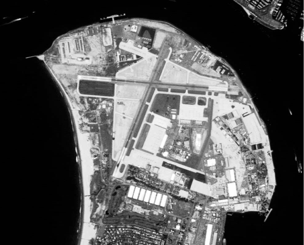
Courtesy of EOSAT Corporation
Figure A-2. Naval Air Station, North Island, San Diego, California.
IRS-1C
5.8-m Resolution
SYNTHETIC APERTURE RADAR TRENDS
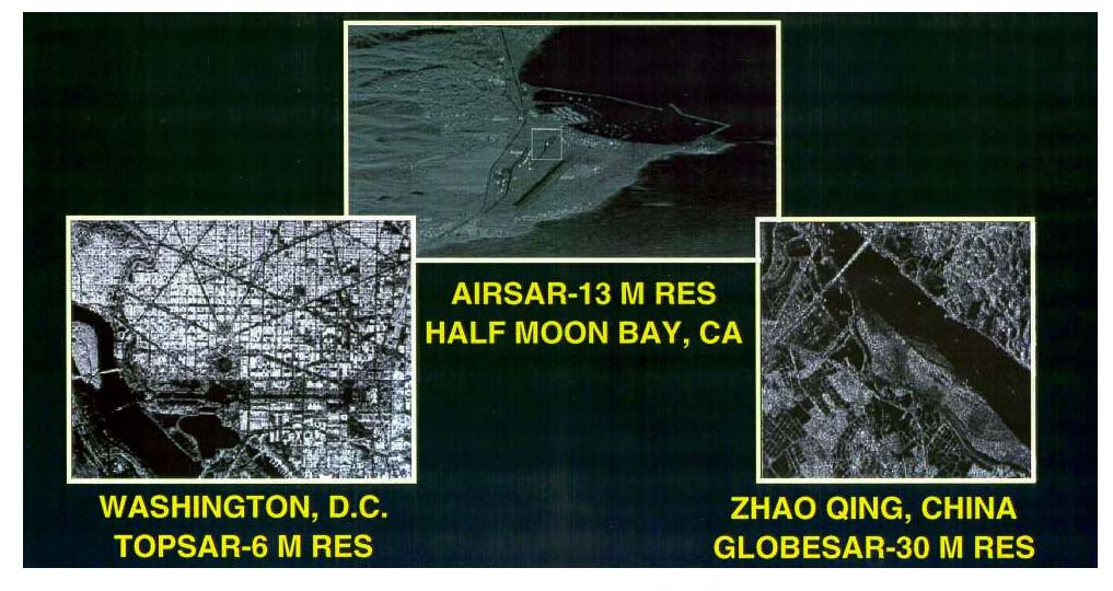
Courtesy of Lockheed-Martin
Figure A-3.
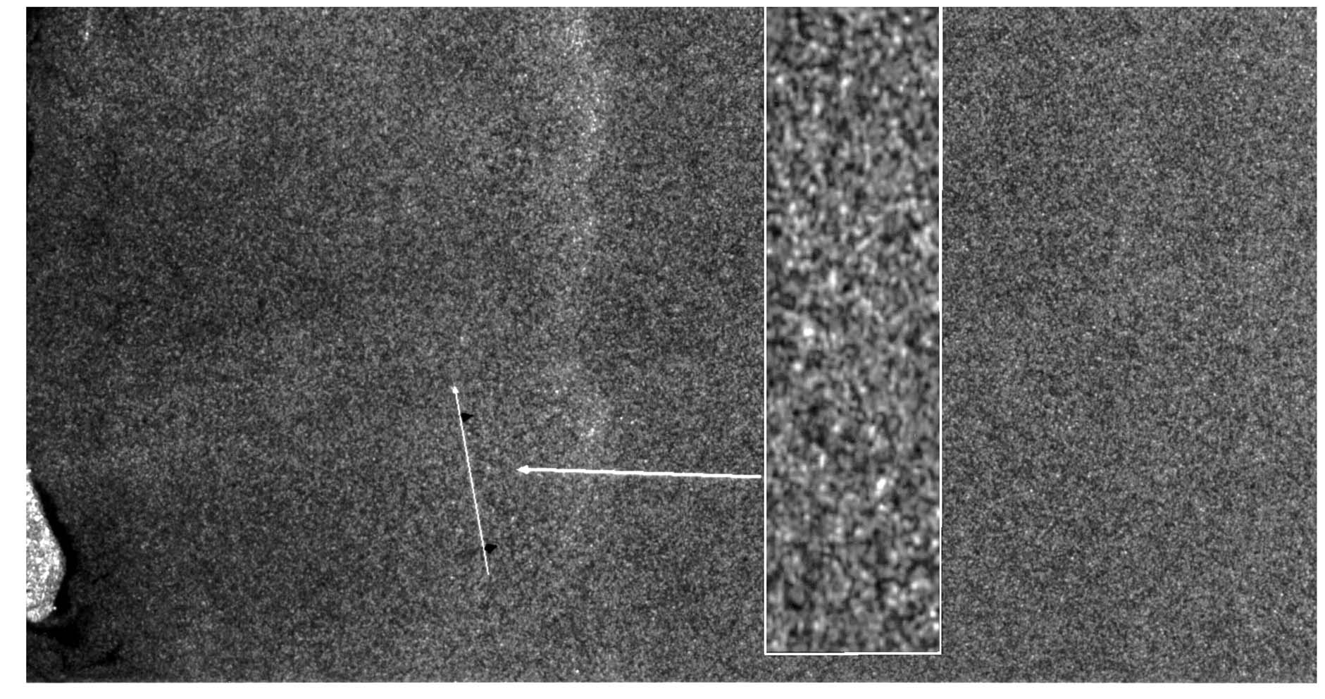
The evolution of space-based synthetic aperture radar (SAR) is towards improving resolutions and multi-mode beam forming capabilities. These air-borne SAR images approximate the progress in improved resolutions which space-based, civil, non-US SARs have accomplished in about a decade. The next improvement in resolution will occur with the launch of Canada's RADARSAT-2 shortly after 2000 which will provide data of 3-m resolution. However, it is currently technologically feasible to build civil SARs which could provide 1-m resolution. If these systems were U.S. owned, they would face political constraints to selling 1-m data. However, other countries would be constrained only by the marketability of such data.
SHIP TRAFFIC MONITORING WITH SYNTHETIC
APERTURE RADAR
SAR data has progressed during the 1990s from 30-m data provided by the European Space Agency's Earth Resources Satellites (ERS series) to 7.5-m data which was introduced by Canada's RADARSAT in 1995. Future systems will provide data of at least 3 m. The following image, provided by Radarsat International, demonstrates RADARSAT's capability for monitoring ship traffic, a capability that previously had been the domain of military satellites only.
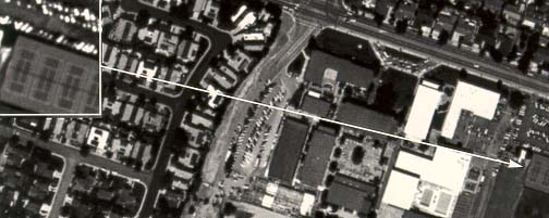
Courtesy of RADARSAT
Figure A-4. RADARSAT image of Singapore Harbor
at 7.5-m resolution. The reflectance patterns clearly
identify these vessels as commercial ships.
OPEN WATER DETECTION CAPABILITY WITH SYNTHETIC
APERTURE RADAR
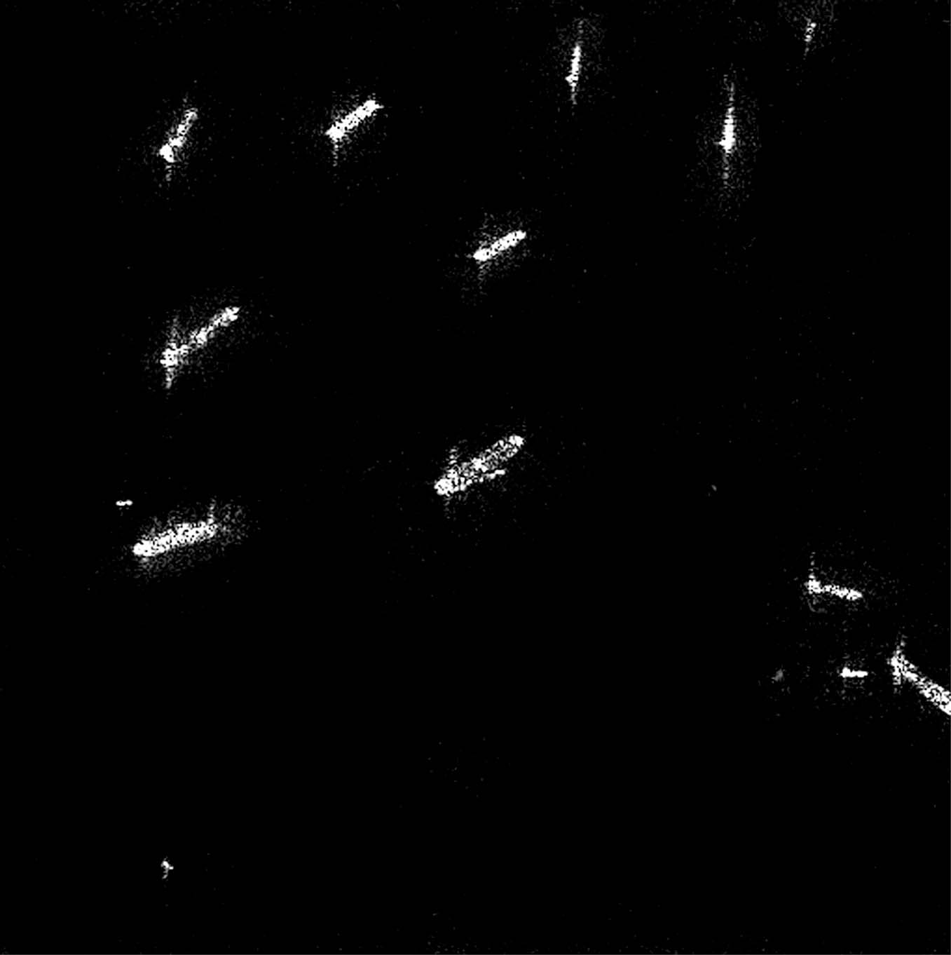
In 1998, RADARSAT's maritime versatility was demonstrated successfully in two exercises. The first, sponsored by the Office of National Drug Control Policy, addressed the ability of a commercial SAR to detect wakes of "Go-Fast Boats." These vessels are the primary means of maritime shipment of cocaine into the United States from the Caribbean and can be detected in the SAR data by the distinguishing feature of the long narrow wakes which they produce. The second, during MARCOT 98 (a NATO exercise held off the eastern coast of Canada), demonstrated several different data maritime utilities of RADARSAT data, including the transmission of time-sensitive location and other products back to the participants. The images below depict the success of using commercial SAR to detect "Go-Fast Boats."
 The "target"
Courtesy of RADARSAT
Figure A-5. RADARSAT image Dec 1997, Standard 25-m
resolution captures long narrow wakes produced by target.
TRENDS IN SYNERGY OF IMAGERY
|
|
1 M |
|
|
1 M MSI |
|
|
FUSED MSI AND PAN 1 M PRODUCT |
Courtesy of Space Imaging in joint project with HJW
Figure A-6.
These simulated space images of Cupertino, CA demonstrate the synergistic effect of combining various types of data. In this case, 0.82-m panchromatic data was combined with 4-m MSI data to produce an image that retained the sharpness of the panchromatic data but added material identifications supplied by the MSI data, thus increasing the accuracy of scene/target characterization.
TRENDS IN SMALLSAT CONSTELLATIONS
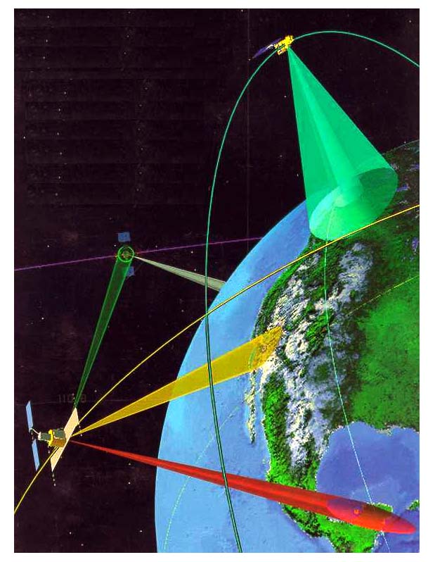
Courtesy of Satellite Tool Kit
Figure A-7.
Advanced lightweight designs, SMALLSAT and LIGHTSAR, will allow constellations of remote sensing satellites to be deployed. Such constellations will provide timely multi-sensor near-global coverage.
Trends in Hyperspectral Imagery
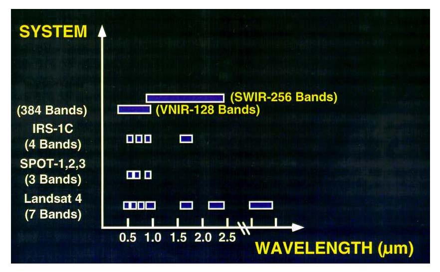
Figure A-8.
Hyperspectral imagery has revolutionalized imagery analysis by expanding the spectral area of collection as well as vastly sharpening the spectral resolution by dividing up the spectrum into several hundred bands instead of 3-7 bands. Instead of a literal image, such as a photo, these sensors will provide a spectrogram of the object's components. These spectral refinements will lead to spectral fingerprints.
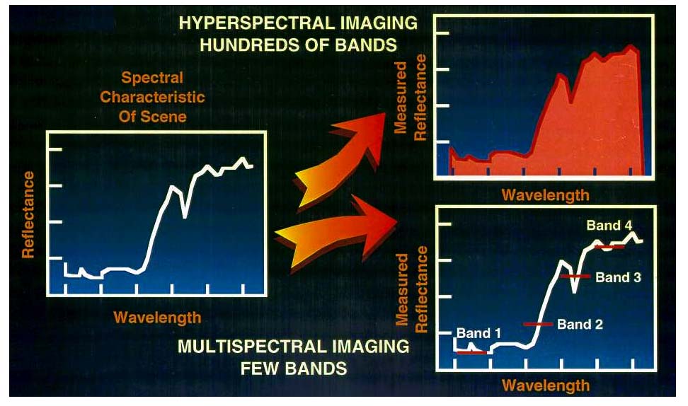
Figure A-9.